


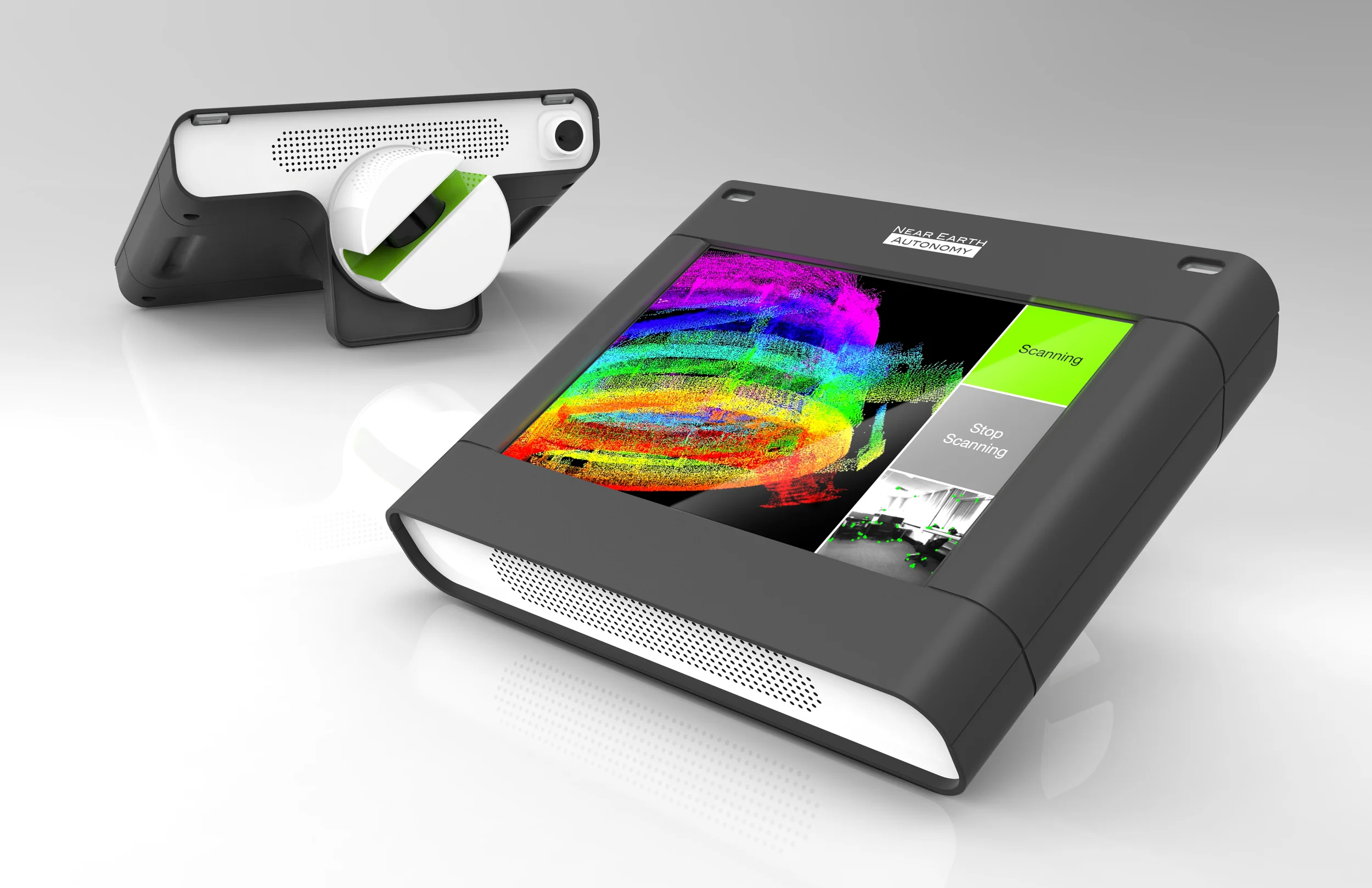
Real Earth, a spin-off of Near Earth, focuses on creating 3D photo-realistic maps for a range of applications such as building infrastructure management, search and rescue, localization, and more.
We were asked to harness existing user data combined with knowledge of the Real Earth technology to create a hand-carried solution. Using rapid prototyping methods, we fast-tracked the industrial design to help create a visual and functional concept prototype within a tight budget.
The hand-carried scanner (named "Contour") is compact and portable. It uses a laser and color camera to create a 3D map real-time in high resolution as the user walks within an interior space.